Connectivity
Connectivity and creating a walkable neighbourhood
Connectivity and creating a walkable neighbourhood
Since the initial presentation of our plans, updated technical work has been undertaken to assess the potential impacts of the East of Luton development on local transport networks. This is included as part of the revised application submissions.
The traffic counts undertaken in 2022 and 2024 have shown lower levels of car traffic when compared to the assessments at the time of the original applications. Our analysis showed an approximate 10% reduction across local road links since 2015.
Furthermore, impacts on the wider network from cumulative development, including at East of Luton, were considered as part of the approval process for the airport proposals. A range of improvements are planned to the highway network in response, including changes to the Vauxhall Way corridor that mitigates this growth.
The focus of our plans is on improving active travel and public transport options, as there is an opportunity to significantly enhance connectivity for pedestrians and cyclists and discourage the use of private cars.
The plans include:
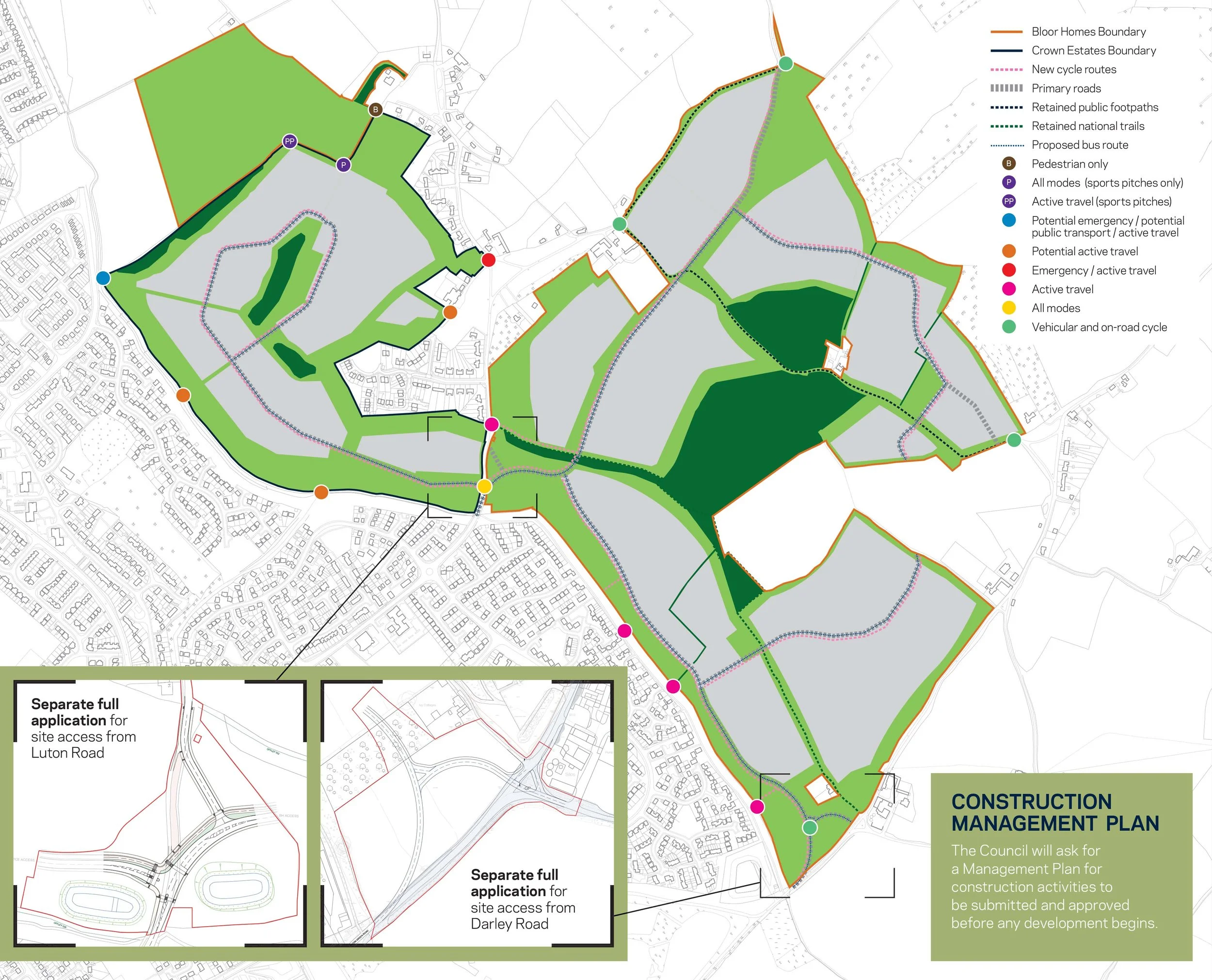
An expanded network of pedestrian and cycle routes throughout the site, connecting key facilities, and linking to the wider local active travel network.
New main link roads through the site for cars, with access points from Luton Road and Darley Road, and predominantly a 20mph speed limit across the site.
A new, high-frequency, bus service serving the local area which puts all homes on site within comfortable walking distance of public transport.
A multi-modal mobility hub at the Luton Road local centre – where people can access forms of travel such as bikes and public transport.
Our transport and connectivity plans:

